BURGHEAD IN BRIEF
By Angela Oatridge
Beaches, Beautiful views, Birds, Bulls, Battles
Burghead is situated on a narrow promontory projecting into the Moray Firth, the word Firth originating from the old Norse word meaning 'arm of the sea'. As you look over the Firth from the promontory you can see the wide arm of water stretching towards the North Sea to the land of the Vikings. To the West the more delicate fingers of The Moray Firth point into the Dornoch, Cromarty and Beauly Firths, the waters flowing into the very heart of Scotland.
Burghead has a lot to offer both resident and visitors with its excellent beach, farreaching views, abundance of flora, fauna and bird life, plus evidence of a more turbulent past when Picts and Vikings fought for power. Add to this the mystic well where stones carved with bulls were found, and a yearly fire tradition called 'Burning The Clavie' which symbolises the ancient fire festivals of primitive man.
Today Burghead is dominated by the huge maltings building which was erected in 1966, then extended in 1971 to double the production capacity, thus making it the largest 'Maltings' in Scotland at that time. This is where the grain used in the production of whisky is prepared, so one might say that this is the real start of the famous 'Whisky Trail', which winds its way through the very heart of Moray. (Details of the Whisky Trail can be obtained from The Tourist Office in Elgin).
Lets now look closer and study the main features of Burghead.
Burghead is surrounded by distant hills and mountains and is the site of the earliest known settlement in The Moray Firth. Maps prepared by the Romans in A.D. 86, show a settlement on the promontory where Burghead is now situated. And it is also believed to be the Alata C astra' or 'Winged C amp' described by Ptolemy of Alexandria in A. D. 160. (Survey of the Province of Moray, 1798)
Burghead has a wide variety of features to attract both day visitors and people who wish to spend a longer holiday in the area, it also is an ideal place to live for both young and old. The proximity of sea, open fields and woodlands, coupled with the extraordinary variety of fauna and bird life, are just a few of the major natural attractions. Add to this the historical connections of an area where it is reputed Romans, Picts, Vikings and even Kings lived.
History stretching back over a thousand years is much in evidence with the remains of what is reputed to be, the largest Iron Age fort in Great Britain. There is also a large Roman type bath, which was discovered in the last century, known as 'Burghead Well'. The origins of 'The Well' still remain one of the many mysteries of the area, who built it? and, what was it used for? are some of the questions being discussed by archaeologists. There is also an old cemetery with stones going back to medieval times, and tales of hearing a child cry if you knock on the 'Cradle Stone', which is situated on the right of the far wan.
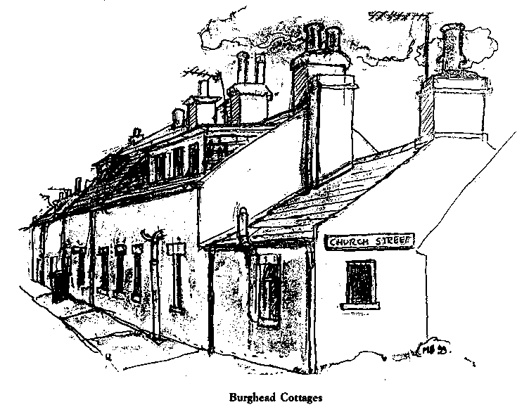
The layout of Burghead as seen today was part of the 'planned village' scheme, which was created in Scotland between 1745 and 1845. The old fisher village of Burghead was demolished at the beginning of the 19th century, along with the major part of its antiquities. This was in order to build the new Burghead, with wide streets laid out in a neat grid pattern which would attract new settlers especially from the Highland Clearances. (Forced migration and emigration of crofters from the Highlands 1780-1855). A new harbour was built at this time, and was enlarged a few years later to allow the London and Leith steamers to enter. The original small pier was destroyed by storms in the 1790's, ten years before the new Burghead was built.
Burghead harbour was once described as one of the safest, deepest and complete harbours in the North of Scotland. A commentator in the 1840's remarked 'That in spite of the best facilities and a harbour that could be used in any wind, there was still room for more boats than the 43 that were based there' (Maclean, 1985 p.69). Today this once busy harbour is peaceful with perhaps no more than a dozen fishing boats. However, there is still the occasional large ship calling in to collect stone, wood or grain, and in the summer months a yacht or other small craft will call in to sample the delights of this small corner of Scotland.
In the past few years much emphasis has been made in the County of Moray, on improving the environment by encouraging the planting of trees, flowers and shrubs. Burghead has responded in no small way, and has won many awards for its floral displays and the cleanliness of the streets. Window boxes in the form of boats, each named by its sponsor, deck the school and many of the houses, conjuring up a reminder of the days when Burghead was an important port. An Annual Floral Market is held at the end of May when pipe bands play, and for one day Burghead becomes the Garden Centre of Moray.
To define the many attractions of Burghead in a small book is very difficult, however if we analyse each of the major attractions briefly, we con perhaps obtain a better picture of this unusual place, and ensure both visitor and resident alike are able to appreciate this jewel in natures necklace of inlets and harbours along The Moray Firth.
CLIMATE
Burghead is situated on the same latitude line as Gothenburgh in Sweden, approximately 68' . Because of this the months of June and July have exceptionally long days, with often only a couple of hours of dusk. It is recorded as having low rainfall, less than 650mm (25in), making the area one of the driest in Great Britain. It is also to be noted that the coastal area of the Moray Firth has fewer thunderstorms than anywhere else in the British Isles, having on average 3 or 4 days with thunderstorms per year, while many places in England have between 15 and 20 days with thunder. (Omand 1976, p.48). Burghead is situated on a peninsula, jutting into the Moray Firth so fresh sea breezes are common, however, fog and even a sea mist is very rare, the air being too dry for the overnight cooling which produces radiation fog.
During the months of June and July the sun sets almost in the north, not in the more usual west.
Recorded hours of sunshine in this area of the Moray Firth are higher than Cornwall.
In the winter of 1829-30 this area was milder than Paris or Rome. (Statistical Account 1842)
WOODLAND WALKS
The area behind the beach is all woodland, this was planted to prevent a re-occurence of the disaster at Culbin, near Nairn when in the late 17th century and early 18th century high winds blew the sand until it became so serious that the homes in Culbin village became almost covered in sand, and the people had to move away. The main estate was also buried in sand, and blown sand was reported as far afield as Duffus and Roseisle.
A narrow ridge of sand dunes lies between the beach and the forest, this area is perfect for sunbathing away from the sea breezes. Within the forest itself there are areas set aside for picknicking and barbecuing as well as many marked walks. The Forestry Commission runs various events to help people enjoy the natural history of this area. Details of events can be obtained from the tourist office in Elgin.
This area is ideal for:
Walking
Discovering unusual fungi
Bird Watching
Capercaillies used to be common in this area, however sightings of these unusual birds are now very rare.
Picknicking
Table, benches and barbecues are to be found near the Roseisle part of the forest
Seeing deer in their natural habitat
Looking at different insects
Discovering wild flowers
Rare flowers like English Stonecrop (Sedum anglicum) which has pink flowers can be found in open places. Also the once common but now rare Oyster Plant (Mertensia maritima) which has unusual blue green leaves and bunches of bell like flowers of light blue.
SIX MILES OF SANDY BEACH
The beach to the west of the town lies between Burghead and Findhorn. There are only three entrances to it, from Burghead, Roseisle Forest and Findhorn. A small spring flows across the beach at a point known locally as 'The Millie Burn' . There used to be a mill here many years ago, however there is little trace of it now.
The beach area is
Safe for bathing. However remember to take normal swimming precautions.
Never crowded.
A perfect opportunity to collect shells, some very curious.
A place to find unusual worms and sea life.
Recorded as one of the most rewarding places in the British Isles for winter bird watching.
Ideal for seeing the famous Moray Firth bottle nosed dolphins.
WALKS ALONG THE ROCKY SHORE
This area to the east of the town is very rocky, with little or no sandy areas. However the walker can be rewarded by an entirely different view, depending if you decide to walk along the old railway track, now a footpath, or the shore line which is mainly rocks and pebbles, with an opportunity to find hidden caves. The sea in this area has a strong undertow and is not safe for bathing.
Here you will see and find:
Rock pools
Different types of pebbles, some quite remarkable
Rare birds
A Grey Tailed Tattler from Siberia has been sighted in this area. Look for Cormorants, particularly in the Autumn. Shags, Black Guillemots are often seen on calm waters, also winter flocks of both Common and Velvet Scoters, Oyster Catcher and Long Tailed Duck. Also common to the area are Goldeneye and Widgeon
Dolphins
Can be seen on a calm day leaping out of the water. Minki Whales have also been seen, but very rarely
Seals
The Moray Firth is home to over 1500 common seals, and up to 500 grey seals come into the Firth in the summer
Opportunity to practice rock climbing
The cliffs near Cummingston bay are ideal for this. You must however take appropriate precautions, remembering that Rock Climbing is a dangerous sport.
Wild flowers down to the water line
The variety of wild flowers in this area, many rare, is amazing. To allow the flowers to multiply, and other people to enjoy them, only look at them, don't pick them. Look for the Meadow Saxifrage (Saxifraga granulata) in the spring, and later the Purple Milk-Vetch (Astragalus danicus). Occasionally one can find cowslips (Primula veris). Masses of Primroses (Trimula vulgaris) can be found on the cliffs in certain places.
Caves
When exploring them be careful you are not cut off by the tide
Fossils and evidence of life here in the distant past
Dinosaurs footprints have been found near Hopeman, and much evidence of life in this area over a million years ago can be seen in the display of rocks at the entrance to the Clashach Quarry. Fossils can be seen in many of the pebbles found on the beach to the east of Burghead
VIEWS
On a clear day you can clearly see the mountains in Caithness and Sutherland, also Dunrobin Castle and the lighthouse at the entrance to the Dornoch Firth. It is said that from the highest point in Burghead eight counties can be seen. (Sutherland, Caithness, Ross, Cromarty, Nairn, Banff, Moray and Badenoch).
Look for:
The sight of an oil rig going in or out of Nigg bay
This is quite a common occurrence.
Cruise lines
'The ‘Queen Elizabeth' and 'The Norway' are just two of the liners which can be seen during the summer months entering or leaving the Cromarty Firth, as they visit the port of Invergordon.
Sunsets
On many evenings the sunsets are equal to those pictured in tropical countries
Northern Lights (Aurora Borealis)
This is a remarkable and strange display of lights in the night sky, which occur when atomic particles penetrate the radiation belt around the magnetic pole, causing them to emit shimmering columns of multi-coloured lights. To see this brilliant display of natures 'fire works' in the sky is an unforgettable experience.
BURGHEAD HARBOUR
Built in its present form in 1818, when the major part of the old fort was removed, it soon became a very busy harbour, by 1840 over 43 boats were based there. Regular steamers plied between Burghead, Leith and Inverness, there was even a regular service to London.
Look for:
The old warehouses used to be used for storing grain and the area for gutting fish. In 1920 there were over a thousand boats gathering in the Moray Firth for the herring season. In 1928 there were 23 steam drifters and eleven motor boats based in the harbour. Originally trains came right up to the harbour to load and unload goods. A walk around the harbour is always rewarding, especially if you have the opportunity to see the fish being unloaded.
Old warehouses
Designed by Thomas Telford, the Scottish engineer (1757-1834) in the last century. Here fishing girls used to gut the fish at the turn of the century.
Fishing boats
Now only a few remain as today the boats are very much bigger and need larger harbours like Fraserburgh and Aberdeen. However it is interesting to watch the fish being unloaded from the local fishing boats which are still able to use the harbour.
Cargo boats
This is still a working harbour and you could see ships unloading grain for the maltings, or loading wood from the forests. Stone from the local quarries can often be seen ready for shipping to Holland or various Baltic ports.
Seagulls
A wide variety of seagulls hover over the harbour, also it is not unusual to see an Osprey diving.
Pleasure boats
Although Burghead is a working harbour, various other boats call including the occasional yacht as well as quite a few local pleasure craft.
SPORTS
Because of its unusual position jutting into the sea, with its choice of both sandy beach or rocky shore line, plus a background of both forest and arable farm land, Burghead offers an unusual opportunity to enjoy a wide variety of sports within a very compact area.
To name just a few:
Bowling
Both indoor and outdoor.
Climbing
The rocks between Burghead and Cummingston provide excellent opportunity to practice climbing. However, remember this is a dangerous sport, and great care must be taken.
Cycling
The wooded area to the west of Burghead provides a large area of safe pedal Cycling. It is possible to cycle as far as Nairn, only using the main road for a couple of hundred yards.
Fishing
This is a major fishing area. The fly fisher will find plenty of opportunities on the many rivers which flow into the Firth which include The Findhorn, Lossie and Spey. For further details of this plus rod and line or deep sea fishing, contact The Tourist Information Office in Elgin.
Football
Burghead has three amateur football teams.
Golf
There are over seven golf courses within 10 miles of Burghead, the nearest is at Hopeman, just two miles away.
Jogging/Running
The forest, the beach or along the old railway towards Hopeman are all safe areas away from traffic.
Orienteering
Ideal area for this relatively new sport.
Scuba Diving
The Moray Firth is a largely unknown but potentially exciting diving area with at times excellent underwater visibility. There are over 100 known wrecks in the Firth. Off Burghead there is reputed to be a U-Boat, but to date this has not been found. There is also the wreck of a Wellington Bomber, the submarine 'Tantivy' and the fishing vessel 'Chrissie Criggle' During the last war five tanks were swamped and subsequently sank while practising for the Normandy Landings of the 1939/45 war on the beaches to the west of Burghead. Only one has ever been found. Inverness BSAC (British Sub-Aqua Club) will be pleased to give you further details on these and other dive sites in the locality. Marineland Leisure Centre in Findhorn provides excellent equipment and advice.
Surfing
The large waves can prove very satisfying for the surfer.
Swimming
Swimming is safe from Burghead beach. There is also an excellent indoor pool and leisure centre in Elgin, which is 10 miles away.
Walking
There are a varied selection of walks in the area. The forest has marked walks and the walk to Hopeman along the coast is particularly attractive with its spectacular sea views.
HISTORY
The history of Burghead goes back over 1000 years, it has been suggested that 2000 years would be more accurate. The traditional Burning of The Clavie on 11th January is believed to go back to the time of The Picts and fire worship. (Details of Burning The Clavie are described under the heading 'Doorie Hill'). Another tradition known as 'Burning the reekie mehr', was carried out in Burghead at Halloween in the nineteenth century, when a cabbage or kail stock, hollowed and filled with kindled tow, was carried by young lads from house to house, puffing smoke into each and every home. (Primitive beliefs in North East Scotland. McPherson 1929 p8.) This tradition has not been carried out in this century.
Because of its situation, a peninsular jutting into the Moray Firth which could be easily fortified, the Picts, the Vikings and it has been suggested that even the Romans were involved in its history, as well as Kings such as Macbeth, Duncan and Malcolm. Macbeth is reputed to have been born between Burghead and Roseisle, and the battle between Macbeth and Duncan which resulted in Macbeth becoming King, is believed to have taken place at Spynie Loch, not far from Burghead. Tales of 'Witch craft' like that of Kirsty McNaughty, who was reputed to have caused a boat to sink, or the more romantic tale of Gunhilda who was rescued by her lover Thorkell in the eleventh century, when the ship she was on was wrecked off Burghead, are just two of the stories of a bygone age. ('Sketches from the Traditional History of Burghead, Jeffrey 1863 p45.)
In 1847 Burghead became involved in the Meal and Grain Riots which were taking place throughout the North of Scotland, when the failure of the potato crop resulted in the price of grain increasing to such a high level that the working man could not afford to buy food. Efforts by local people in the North East to stop shipments of grain had little effect, except in Burghead where a mob of about 500 men seized the grain from ships in the harbour and distributed it among the local inhabitants. The Sheriff of the County gathered a body of men to enforce the law. On arrival at Burghead they were met by the rioters who were armed with stones, lug bait spades, and other suitable weapons which were to hand, resulting in the Sheriff's party being routed, some seriously injured. Eventually a number of Burghead and Hopeman men were arrested and tried at the court in Inverness where many received five or seven years penal servitude. (Traditional History of Burghead. Alex Jeffrey Jun 1894 p75.) This event is remembered locally as 'The Battle of Burghead'.
Look for:
Iron Age Fortification
There are remains of an ancient fort on the headland. It is estimated that a whole forest of oak trees was used to build the fort which was subsequently used by the Picts and the Vikings. It was believed to have been burnt in the 8th century. Legend described how combustible materials were attached to the tails of birds who nested in the thatch of the fort and then ignited. The poor birds immediately flew in distress to their nests, thus setting the thatch on fix, and destroying the fort. (Statistical Account of Scotland. 1793). However the Fort was in regular use until the tenth century, there is little evidence of it being occupied after that period, although it was no doubt used for storing various materials used in the village. A major part of the fort was eventually destroyed in the last century when the new town and harbour were built, when many rare finds were made. These included Pictish symbol stones, each with a fine bull engraved on them. These can be seen in Burghead library window and in Elgin museum, as well as in museums in London and Edinburgh.
Doorie Hill where you can see the 'Clavie Chimney'
On January 11th each year, which is the Pagan New Year, the ancient ceremony of Burning The Clavie takes place in Burghead. The Clavie is a tar barrel which is filled with wood and tar then set alight. This burning mass is carried around the streets of Burghead by The Clavie King and his crew, followed by cheering crowds as periodically the Clavie King stops outside a designated cottage, and a piece of burning wood is handed to the resident. (In former times the burning wood was thrown into the cottage). The burning barrel is then taken to The Doorie Hill where it is placed on the Clavie Chimney. Here, as the crowd cheer wildly, more fuel is thrown on the fire setting the whole of the hill alight. The crowd stay until the Clavie falls down, before returning to open houses which offer hospitality and friendship, plus free entertainment and food which is provided in the local hotels and inns in order to celebrate the successful welcoming of the traditional Burghead New Year. (The Clavie tradition never takes place on a Sunday. When 11th January is a Sunday this traditional event will be on Saturday 10th January.)
Burghead Well
The well, which is shaped like a Roman bath, was discovered in the last century, however there is little evidence that the Romans were here. It has been suggested that it was used for sacrificial purposes by the Picts, however as the water is fresh it implies it could have been the fresh water supply for the fort. It is recorded that an old man in 1863, described seeing in his youth an inscription on a stone found in the vicinity of the well, which read - 'Here lies the King of the Danes, with three and thirty thousand of his men' ('Sketches from The Traditional History of Burghead' Alex Jeffrey 1863 p15.)
The Old Chapel Yard
It is believed that the original church which stood here was built at the end of the 6th Century. Note the cradle stone on the far wall, (identified by a hollow in the wall) where a child's cry is reputed to be heard if you knock the hollow with a stone. The oldest readable grave is Robert Shaw's dated 1689, and the oldest person was John Fimistor, who was 105 when buried here in 1807.
The Churches
There are three old churches in the town, the original Parish Church was erected in 1822, however in 1946 it became a Community Hall. Inside are some remarkable paintings of Burghead in the 1970's by local artist George Smilie. The present Church of Scotland was originally built in 1821 and was rebuilt at the start of this century. The Free Church hall housed the original Burghead school until the Education Act of 1875, when the present school was built.
The School
The original school was burnt down by accident, on 7th April 1886, however it was rebuilt in its present form and ready for use by September of the same year. Note the unusual spired bellcote (bell tower) on the school which is of an almost delicate design. Also note the gables above the windows of the original part of the school.
The Railway Station
The original station was built in 1863 on the area now called the Salmon Green. The first train arriving on 22nd December of that year. This station was burnt down in 1871, when a clerk tried to hide the fact that he had been taking money. The present station was built in 1892 when the line was extended to Hopeman. The Beeching cuts in 1963 affected the whole of the Highland lines and Burghead was no exception. At the moment there are no trains to Burghead and discussions are taking place to find a way of using the station, which is a listed building, for the benefit of the community as a whole. Students from Robert Gordon University in Aberdeen who are carrying out a study of Burghead, state "that it is the only example left of an unspoilt Victorian wooden and iron station in Scotland".
The Memorials
The war memorial is to the memory of the young men of Burghead who died in the two world wars of the 20th Century.
The small memorial situated behind the war memorial, is to a local young man, Benjamin Maclean M.A. He was a student of Divinity and lost his life on 26th August 1909 in a successful attempt to rescue a young doctor who had foolishly gone swimming at a dangerous point near The Red Craig. The doctor had stated his intention of 'battling the waves' to Benjamin who had warned him of the dangers of swimming in that area, but the warning was ignored. Although Benjamin managed to save the doctor, the effort required caused him to become exhausted, resulting in his drowning. The memorial was erected by the people of Burghead. On the memorial it quotes from The Bible, 'Greater love hath no man than this, that a man layeth down his own life for his friend' (John 15).
The Harbour
The harbour was built in the last century destroying a large part of the fort in the process. Originally there was a small pier which was destroyed by storms at the end of the nineteenth century. However in viewing this area you must remember how dangerous and harsh the life of the fisherman was when boats were operated directly from the shore. Boats had to be pushed over the beach into the water at every launching, and on return to shore had to be hauled above the high water mark. The boats were open to all weathers, and the men were often at sea for days at a time, living on cold food with no shelter from the rain and winds. However for the women folk the life was even harder, besides having to give birth to the children, cook and care for the family. In The Original Statistical Account' it states:
'The fisher wives lead a most laborious life. They assist in dragging the boats on the beach, and in launching them. They sometimes in frosty weather and at unreasonable hours, carry their husbands on board to keep them dry. They receive the fish from the boats, carry them fresh, or after salting, to their customers, and to market ... through bad roads and in a stormy season ... It is the province of the women to bait the lines, collect furze, heath or the gleaning of the mosses, which they carry home in their creels for fuel. (The Statistical Account of Nairn, Moray and Banff 1791).
Traditions and Annual events in Burghead
Burning the Clavie - 11th January
(See under History 'Doorie Hill')
Charity Swim - 26th December
During the annual Charity Swim across Burghead Harbour, hundreds turn out on this cold day to watch brave volunteers dive one at a time into the harbour, to swim from one side to the other.
Floral Market
This normally takes place on the last Saturday in May. Plants, flowers, trees, gardening tools, anything to do with gardens or flowers are on sale at this most northern floral market.
Where to eat
Besides the many areas for enjoying a picnic, for those who wish to buy a snack or full meal Burghead has a good variety of places to eat.
The Beach Cafe, Granary Street
Commercial Hotel, Young Street
Corner Cafe and Chip Shop, 18 Brander Street
The Granary Bakery, 1 Young Street
The Harbour Inn, Granary Street
Station Hotel, 2 Brander Street
Where to shop
Burghead Post Office, 49 Grant Street
Davidsons Drapery, 44 Grant Street
Granary Bakery, 1 Young Street
Fairways Off Licence, Brander Street
SPAR, 47 Grant Street
Tele tex, 20 Grant Street
Vantage Pharmacy, Chemist, 18 Grant Street
Burghead has been compared with Edinburgh as an example of how towns and cities developed through the ages from an historic stronghold on the Scottish coast to a busy port and a spa in the nineteenth and early twentieth century. Burghead in particular has evidence of a brutal past, with its history of conflicts with the Vikings, and the burning of The Fort. The final destruction and rebuilding of Burghead at the start of the nineteenth century resulted in it becoming a popular spa in Victorian times, and an important cog in the fishing industry.
Burghead has moved into the present century with its two great wars, and the decline in the fishing industry, managing to keep a culture, and traditions, which will ensure that it is an ideal place to live or visit, in the 21st century.
The text of this piece is available as a booklet, lavishly illustrated with line drawings by Mailyn Bryant and printed by the Moravian Press Ltd. To order your copy send a cheque for Four Pounds if you are in the UK (5 British Pounds or 10 US Dollars if you are overseas) to Angela Oatridge, 11 Firth View, Burghead, Morayshire, Scotland IV30 2YW giving your full postal address.
Go to the Oatridge Home Page. Please help keeping this site going by visiting our advertisers.